 Image 1 of 3
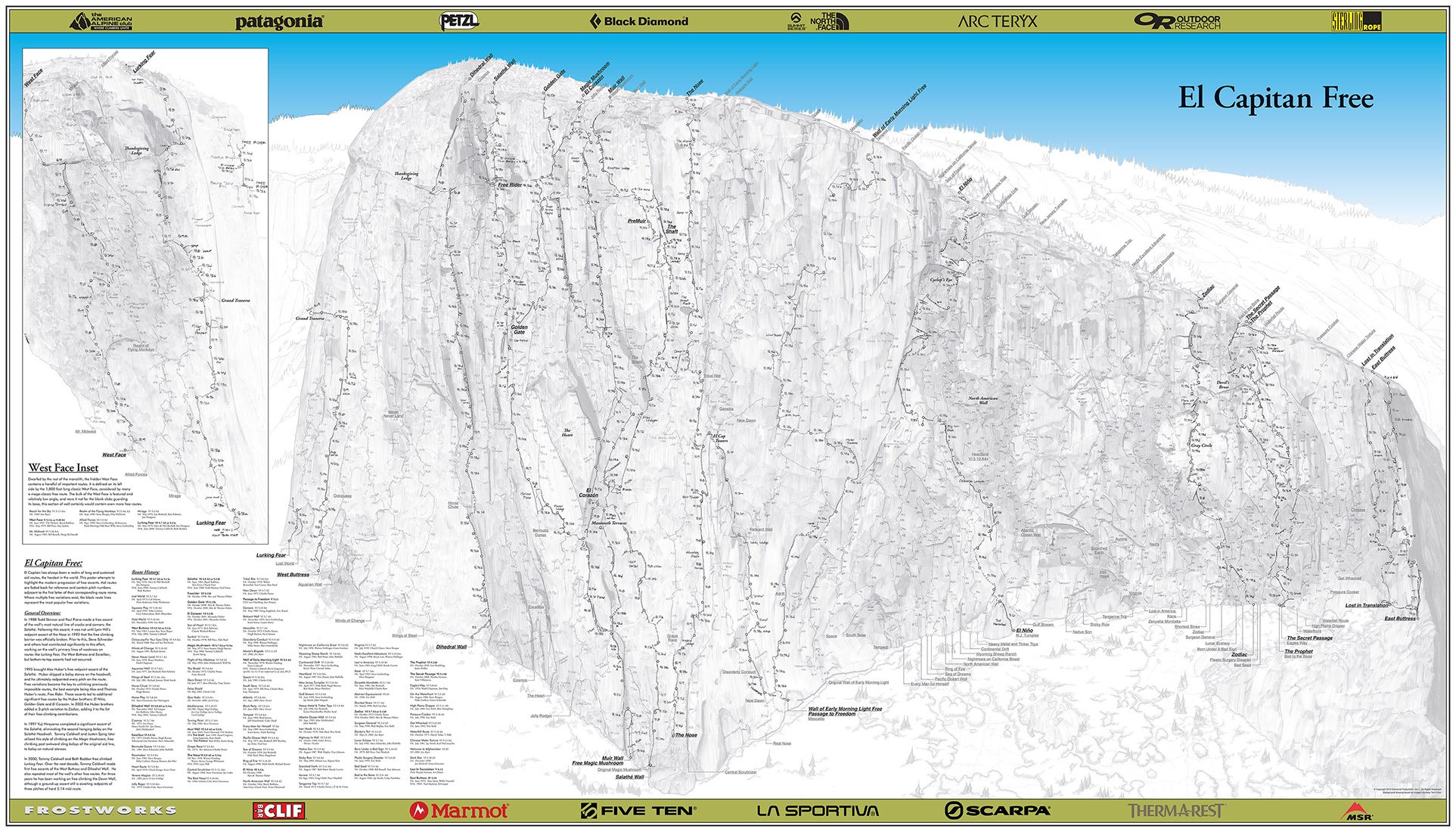 Image 2 of 3
 Image 3 of 3
El Capitan Free, Yosemite National Park, CA
PUBLISHED IN 2012, FIRST EDITION • SIZE: 36" X 63"
This giant climbing poster map has all of the routes on El Cap. It is the realization of my original vision of my artwork, both in size and content. Thanks to Jimmy Chin, I received a call from National Geographic in 2010. They commissioned the base image of this poster and it was the "centerfold" of their May 2011 cover article on free climbing in Yosemite. Again, Tom Frost's never-ending support kept me moving forward, and in the end, my artwork was shared with 8.3 million people in 36 languages.
A year later, using the National Geographic base images and expanding them around the corner to include the West Face, I created the ultimate base image of every feature on El Capitan. A lot had happened in Yosemite National Park in the decade since I drew the Southeast Select poster, and I was able to research and draw topos for 20 free climbing routes on El Capitan.
Another amazing asset was the Yosemite Extreme Pano Imaging Project by xRez Studio. This website brought a telescope right onto my computer screen where climbers like Tommy Caldwell could sit next to me and point out beta in amazing detail. The poster chronicles the evolution of the wall's free climbing routes and includes the underlying matrix of the wall's aid routes for reference.